Day 3 is the Shakotan Peninsula drive. A full day along the coastline of a peninsula jutting into the Sea of Japan, with stops at Bikuni Ōgon-misaki and Cape Kamui. The view I most wanted to see in Hokkaido was here.
The Shakotan coast — see-through Sea of Japan
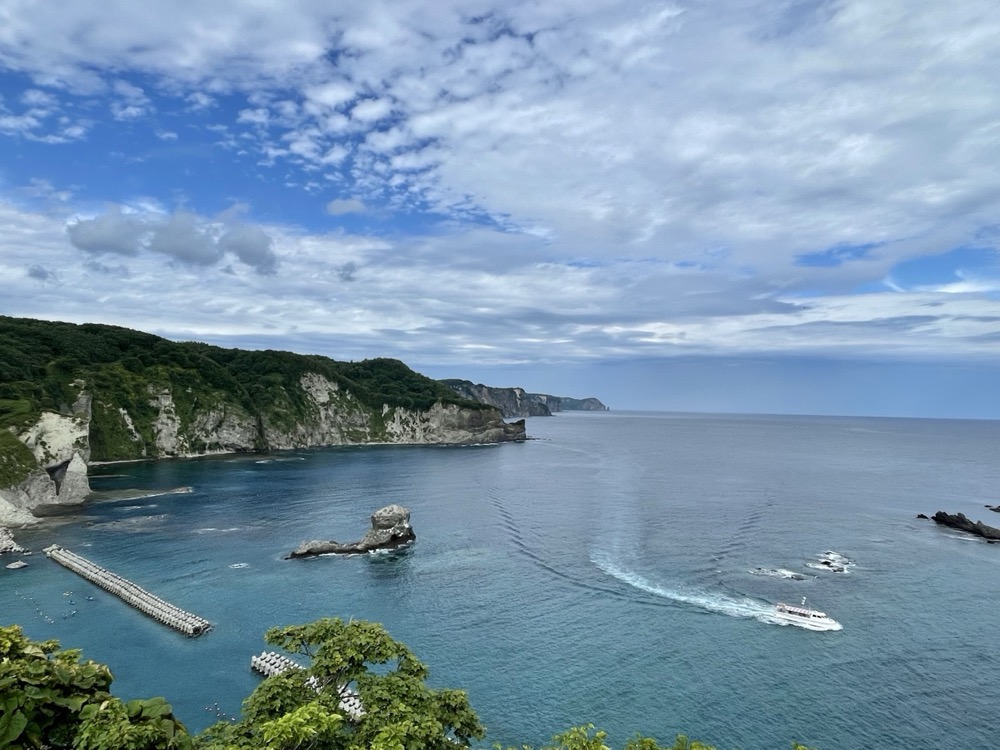
Out of Yoichi west on Route 229. As you ride the coast, the water gets clearer and clearer. Green mountains, sheer sea cliffs, and a road that threads between them. Out on the peninsula, the so-called Shakotan Blue finally shows itself.
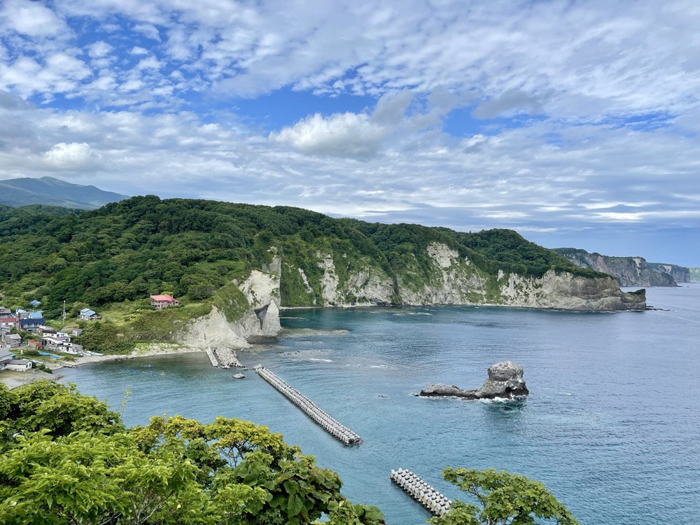
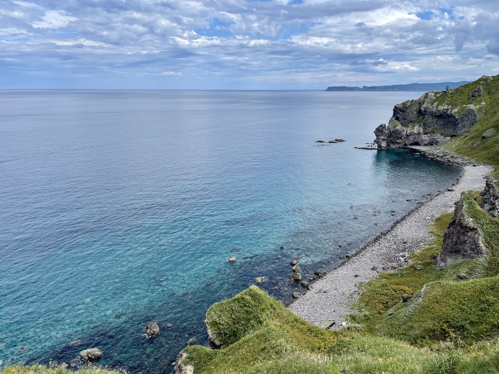
Bikuni Ōgon-misaki — a morning cove
On the way to Cape Kamui I stopped at Ōgon-misaki in Bikuni. It's often confused with the same-named cape in Rumoi, but this one sits on a height above the small fishing town of Bikuni on the Shakotan Peninsula. Below: a turquoise cove, a fishing harbor, and a scatter of rocks across the surface. Many fewer visitors than at Cape Kamui — a hidden viewpoint you can almost have to yourself.
Cape Kamui — the "no women allowed" cape
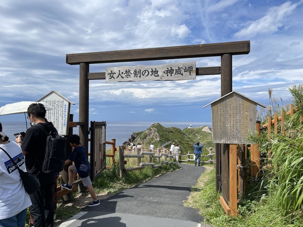
Past Bikuni, further west. Cape Kamui sits at the tip of the Shakotan Peninsula, a long thin spit jutting into the Sea of Japan. From the parking lot, the "Charenka Path" walking trail takes about 20 minutes to the tip. At the entrance there's a wooden gate marked "No women allowed." It's a traditional sign rooted in the late Edo period, when the Matsumae Domain banned women from entering. Today it isn't enforced — it remains as a symbol.
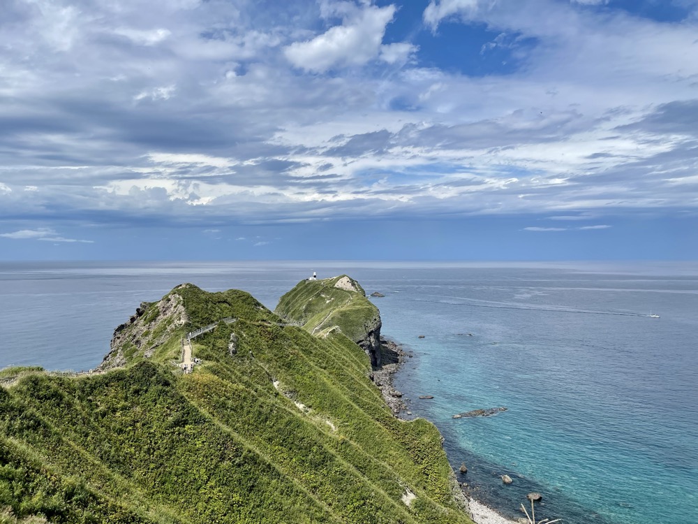
The trail winds along a sharp ridgeline — cliffs both sides, the Shakotan Blue underfoot. On windy days it can be a little frightening, but the view more than makes up for it.
From the viewpoint, the blue of the Sea of Japan really does deserve the name Shakotan Blue. The water is so clear you can see down to the rocks in the shallows.
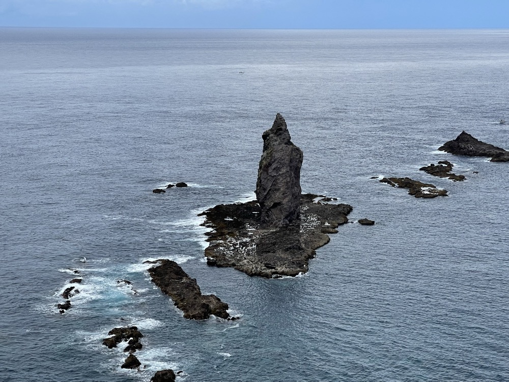
And at the cape's tip: Kamui Rock, rising sharp from the sea. The icon of Cape Kamui. As the Ainu word "kamui" (god) suggests, this place has been treated as sacred since long ago.
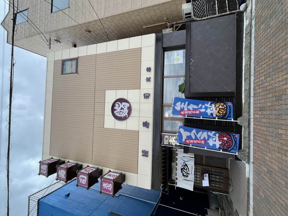
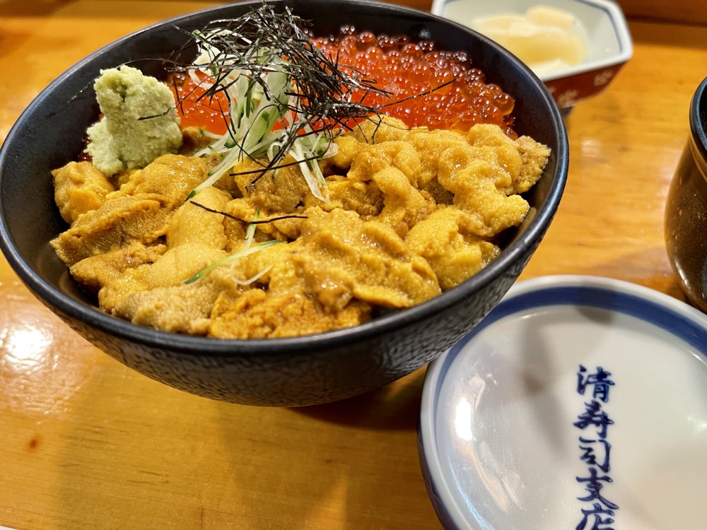
Kiyozushi Branch — Bikuni's uni-ikura don
A late lunch at Kiyozushi Branch in Bikuni. The Shakotan Peninsula is famous for summer sea urchin; June through August, fresh bafun-uni shows up on the counter. I ordered the uni-ikura don. The creamy sweetness of bafun-uni against the salt-pop of salmon roe over rice — a bowl you can only get on the Shakotan in summer.
In the evening, a long drive back to Hakodate. From Shakotan to Hakodate is over 250 km, about four and a half hours — a transit day to make it back in time for the morning market.
Shakotan Blue was even more vivid in person than in any photo. The view I most wanted to see in Hokkaido was here.
Travel guide (general info)
※ This section combines public information with the author's notes; please confirm the latest fares, hours, and road conditions on the official sites.
Cape Kamui
- Where: at the tip of the Shakotan Peninsula. From the parking area, walk the "Charenka Path" — about 20–25 min one way to the lighthouse.
- "No women allowed" history: an Edo-period rule once forbade women from passing north of Cape Kamui (lifted in 1855).
- Opening hours: vary by month (gates open around 8:00, closing between 16:30 and 18:30; December–March reduced to 10:00–15:00). Gates close on days with strong winds. The path to the tip (Charenka Path) closes for winter and reopens in spring after safety checks.
- "Shakotan Blue": most vivid on calm, sunny mornings; on rough or cloudy days the water turns a flatter grey-blue.
Shakotan sea urchin and seafood
- Sea urchin season: June through August only (set by the local fisheries cooperative); fresh raw uni is limited to this window.
- Restaurants: sushi spots and small diners are clustered around Bikuni, Yobetsu, and Cape Kamui — expect lunch waits in summer.
- Sei-zushi Branch (Bikuni): near Bikuni Port; uni and ikura bowls are the signature.
Driving the Shakotan Peninsula
- Route 229 (west coast): a scenic coastal stretch with many tunnels and rapidly changing views.
- Counter-clockwise recommended: Yoichi → Bikuni → Cape Kamui → west coast → Suttsu lines up best with the morning-to-afternoon light.
- Fuel: gas stations on the peninsula are scarce — fill up at Yoichi, Furubira or Suttsu and plan ahead.