I've been to Hokkaido three times: twice by motorcycle, once by car. The destinations and styles were different each time, but they share one feeling — vastness. Straight roads you don't get on the main island, sunsets you don't get on the main island, a quiet you don't get on the main island.
This page collects the routes, lodging, and standout spots from all three trips, so anyone planning their own Hokkaido trip can use it to sketch out a route.
Note: the day-by-day chapters for some trips are still being translated. For now, links to those chapters lead to the Japanese version of the article — feel free to read in Japanese, or check back as translations are added.
Hokkaido Route Map (all three trips)
The routes from all three trips are overlaid on the Hokkaido map below. Click or tap a line to jump to that trip's section.
The Three Trips at a Glance
- ① SR400 Solo Tour — Esanuka Line, Northern Hokkaido
- ② Solo Drive by Car — Cape Kamui, Hakodate, Southern Hokkaido
- ③ XSR900 8-Day Tour — From Ōarai, looping the East and North
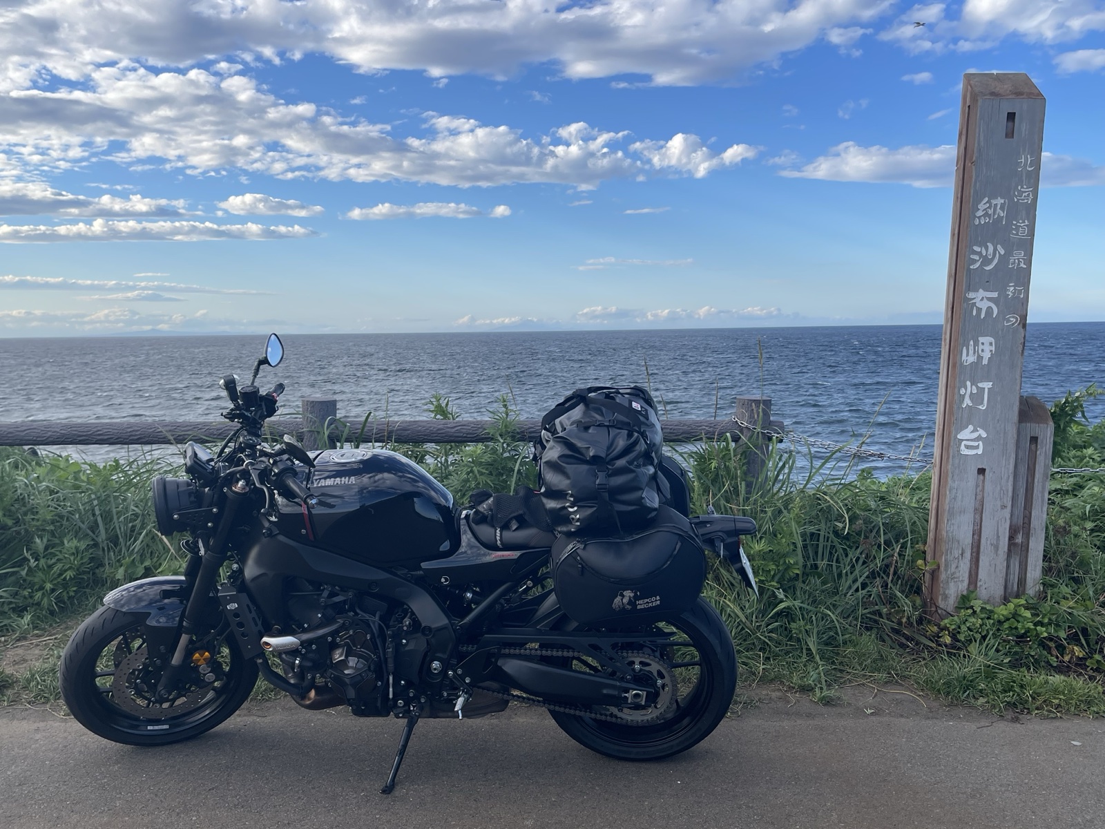
① SR400 Solo Tour — Northern Hokkaido and the Esanuka Line
The record of taking my SR400 to Hokkaido. The Esanuka Line moved me almost to tears — empty straight road stretching as far as you can see. In Monbetsu, on a mountain road heading to the Okhotsk Sky Tower at dusk, I came face-to-face with a Higuma (Hokkaido brown bear).
Northern Hokkaido was ridden along Route 232 (the Ororon Line), heading north through Rumoi, Obira, Tomamae, and Haboro. Past Teshio, I picked up Prefectural Road 106 (Wakkanai–Teshio Line), the famously power-pole-free single road across the Sarobetsu Plain (the so-called "longest straight road in Japan"), with the Sea of Japan on my left, all the way to Wakkanai. I doubled back and detoured constantly, but mostly stayed on the coast. From Wakkanai I went via Cape Noshappu, looped the western coast, and pushed on to Cape Sōya.
📍 Open route in Google Maps (Ōarai → Sapporo → Ororon Line → Wakkanai → Cape Noshappu → Cape Sōya → Esanuka Line → Monbetsu → Biei → Furano → Ōarai)
Day-by-day Records
Lodging
- Day 1Hotel Livemax Sapporo Ekimae / Sapporo (the previous night was on the Ōarai → Tomakomai ferry)
- Day 2Onsen Minshuku Kita-no-Yado / Fujimi, Wakkanai
- Day 3Monbetsu Prince Hotel / Monbetsu
- Day 4Hotel Lavenir / Biei (next to Roadside Station Biei "Oka-no-kura")
- Day 5Tomakomai → Ōarai ferry (Sunflower)
Main Stops and Sights
- Sapporo: Former Hokkaido Government Office (Red Brick), Ramen Ichiryūan
- Ishikari: Roadside Station "Airoad Atsuta"
- Ororon Line: Wind-turbine clusters, Otonrui Wind Farm, the long coastal straightaway
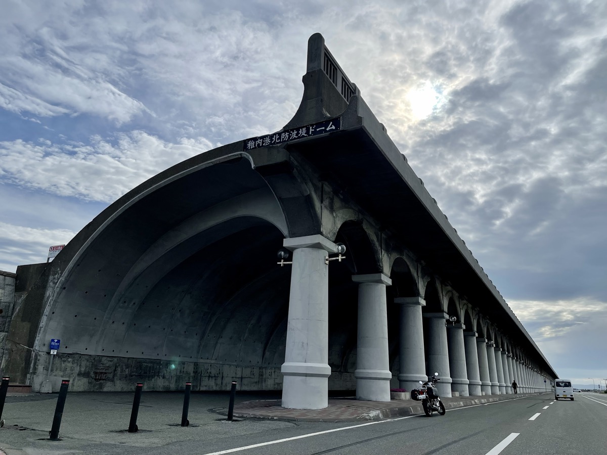
- Wakkanai: Wakkanai Port North Breakwater Dome, Wakkanai Station (Japan's northernmost railway), Cape Noshappu (reached by riding the western coast)
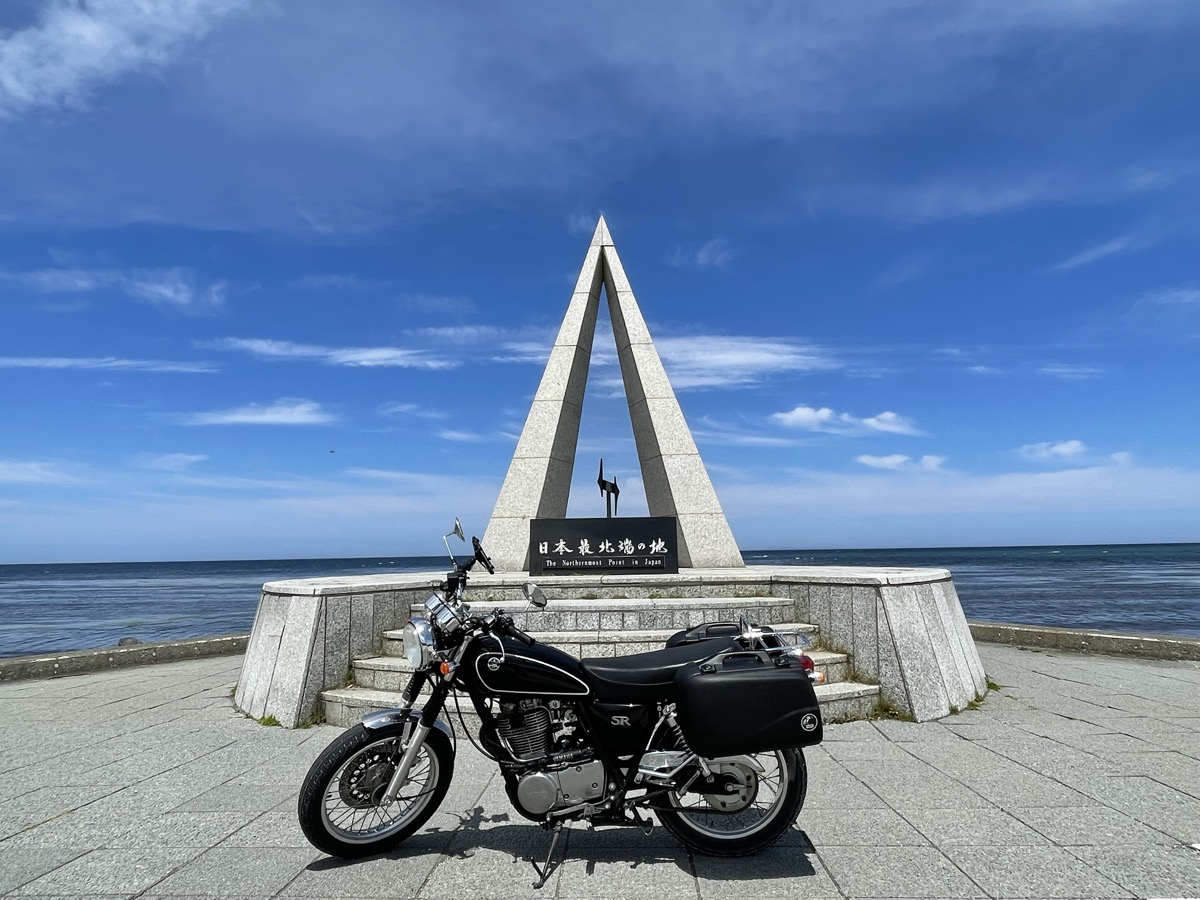
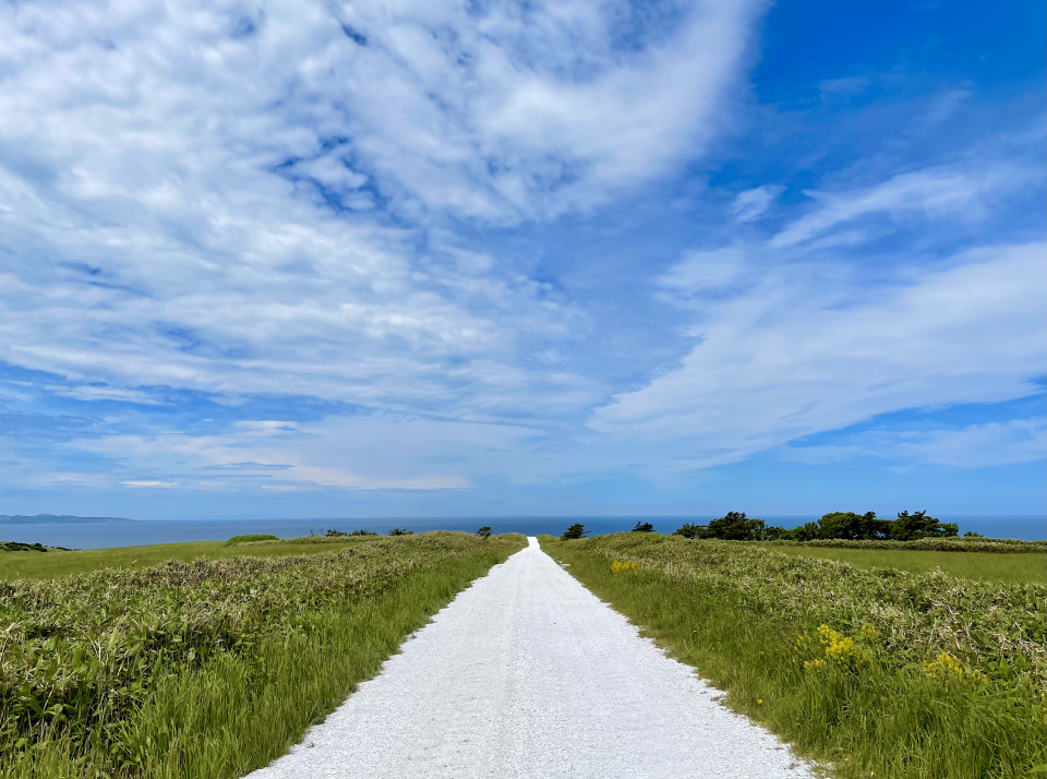
- Sōya: Shiroi-michi (White Road), Sōya Hills, Cape Sōya (Japan's northernmost point)
- Sarufutsu Village: Esanuka Line
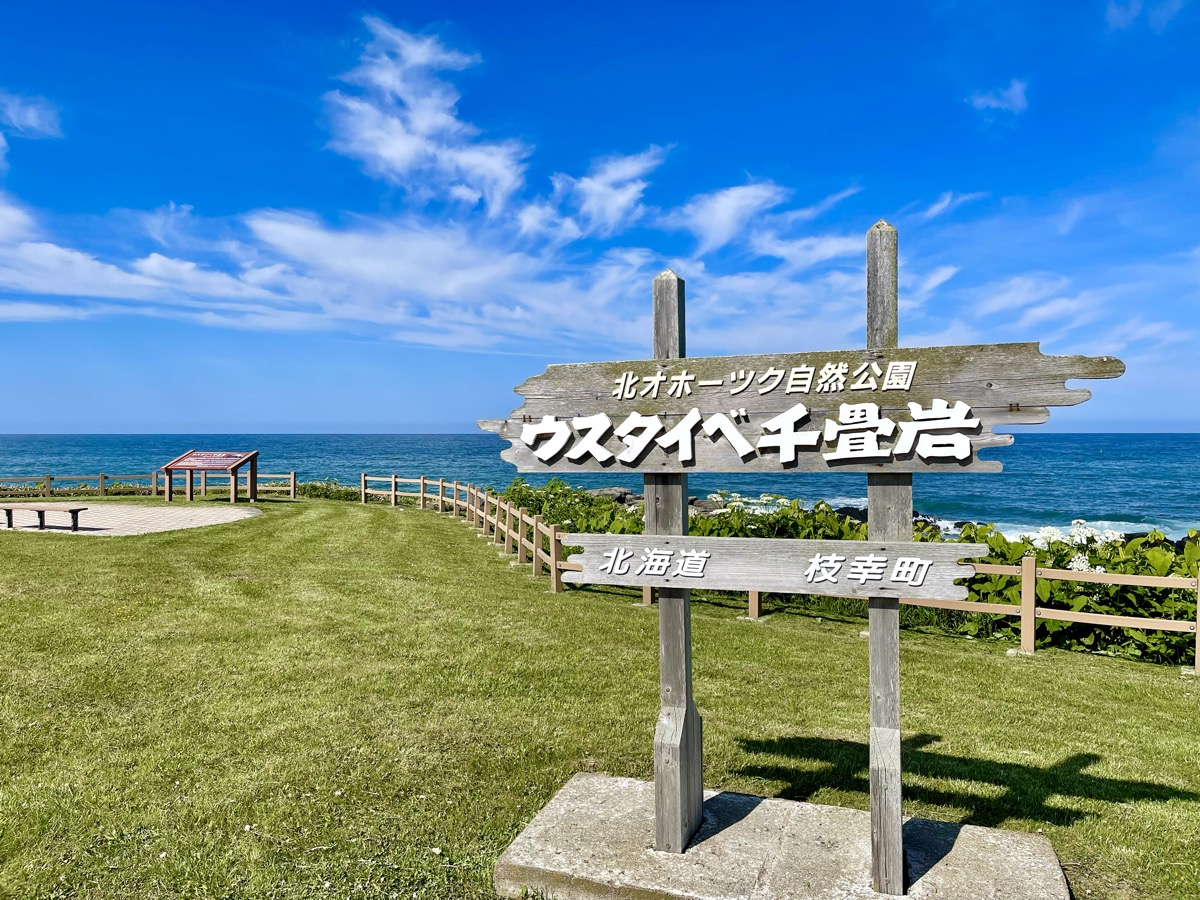
- Esashi Town: Usutaibe Senjōiwa
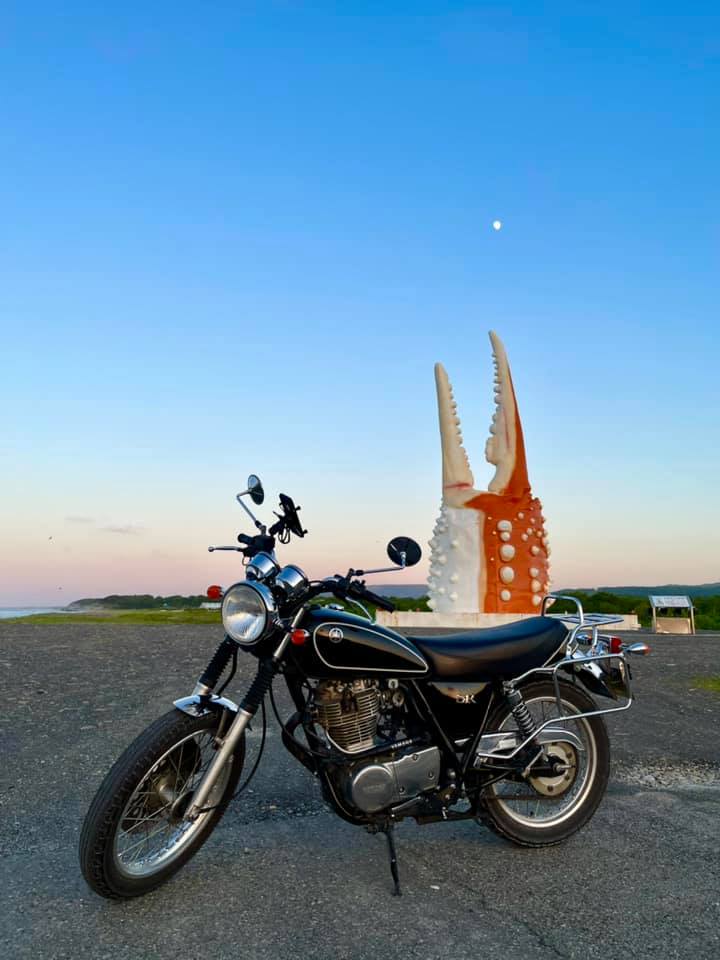
- Monbetsu: Crab Claw Monument, Okhotsk Sky Tower
- Kamifurano: Saerubu-no-oka
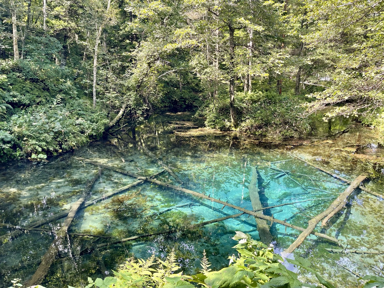
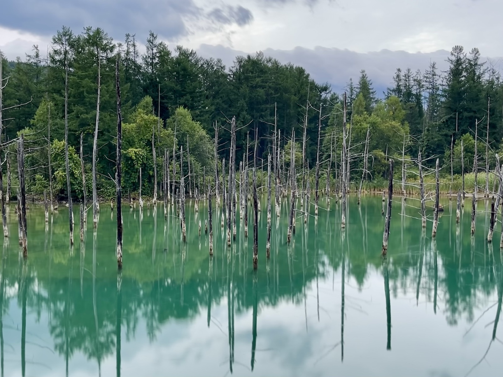
- Biei: Blue Pond, Ken & Mary Tree, Seven Star Tree, Patchwork Road, Roller-Coaster Road
- Furano: Farm Tomita (lavender fields)
Trip Highlights
② Solo Drive by Car — Southern Hokkaido, Cape Kamui, Hakodate
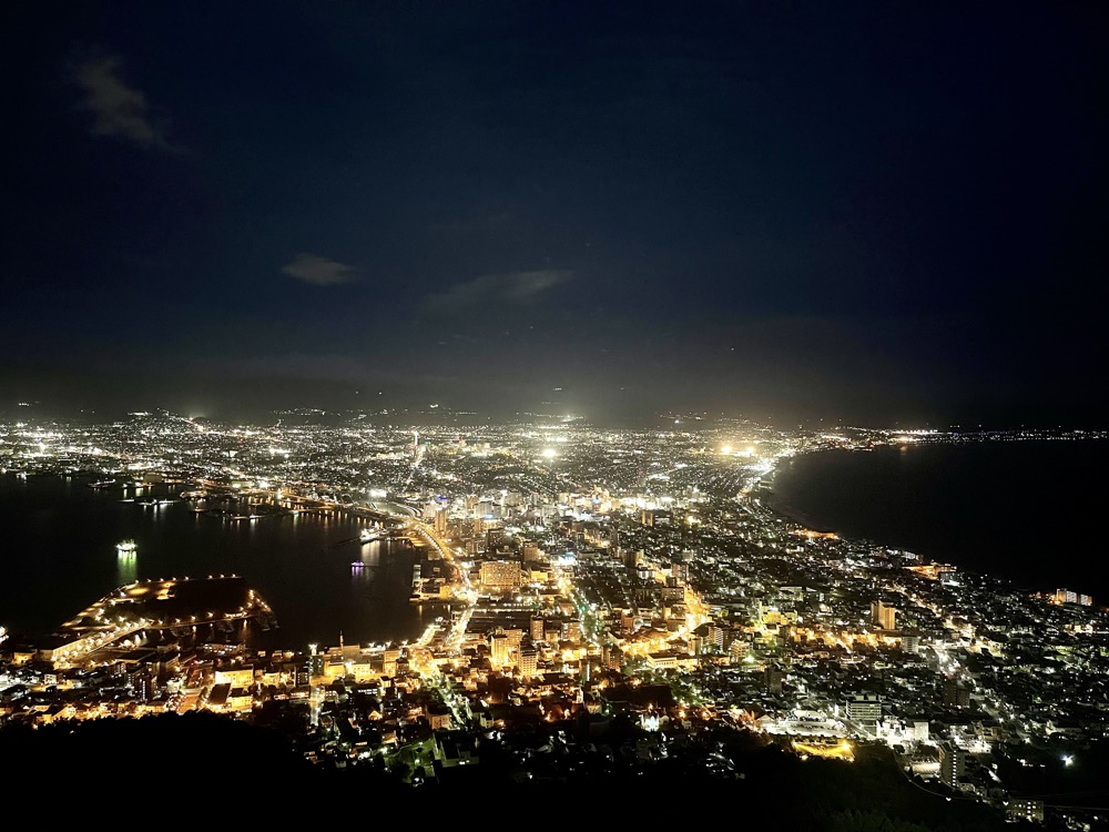
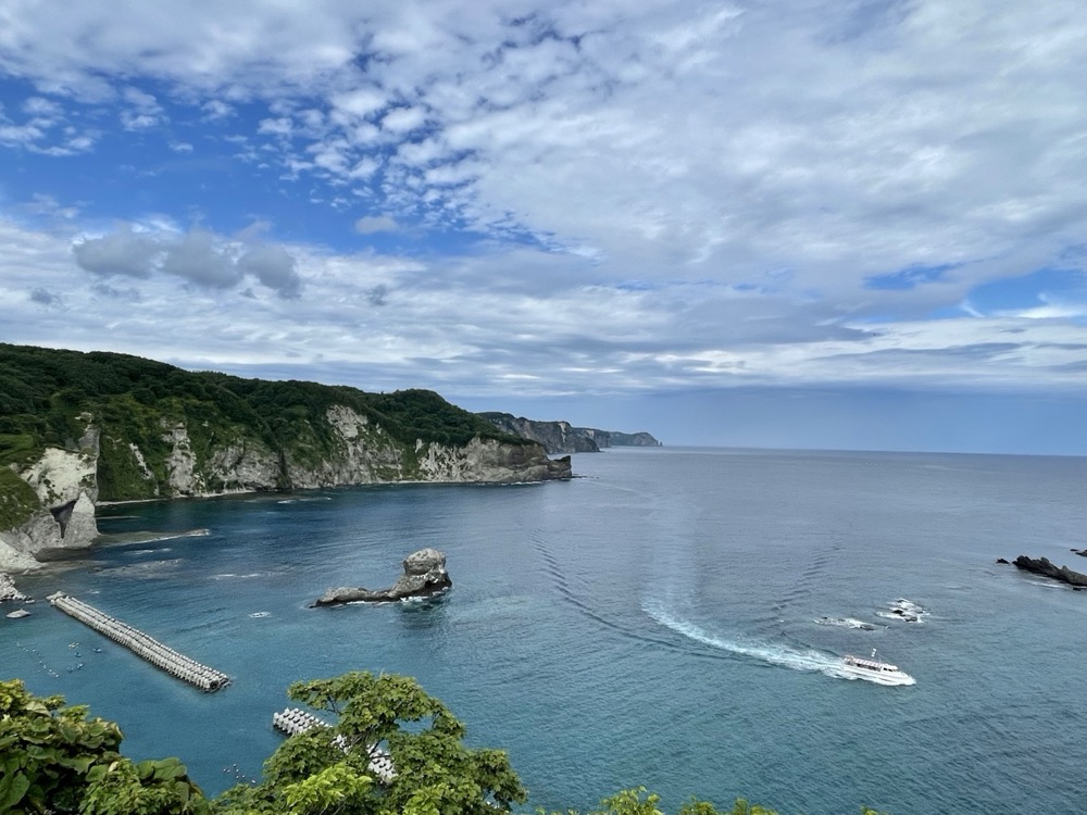
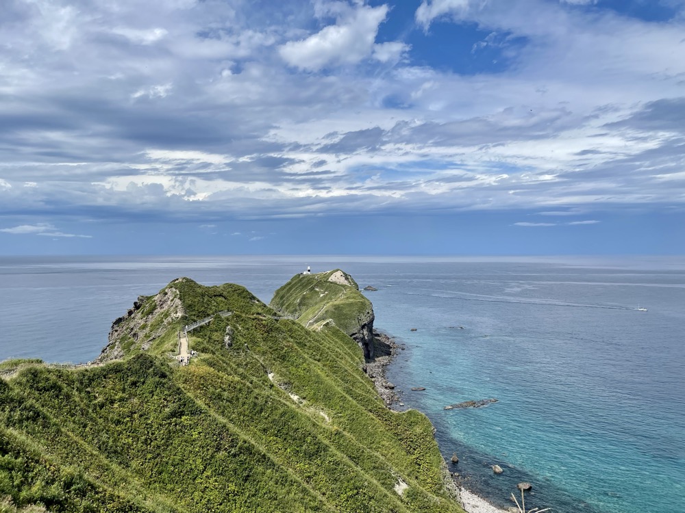
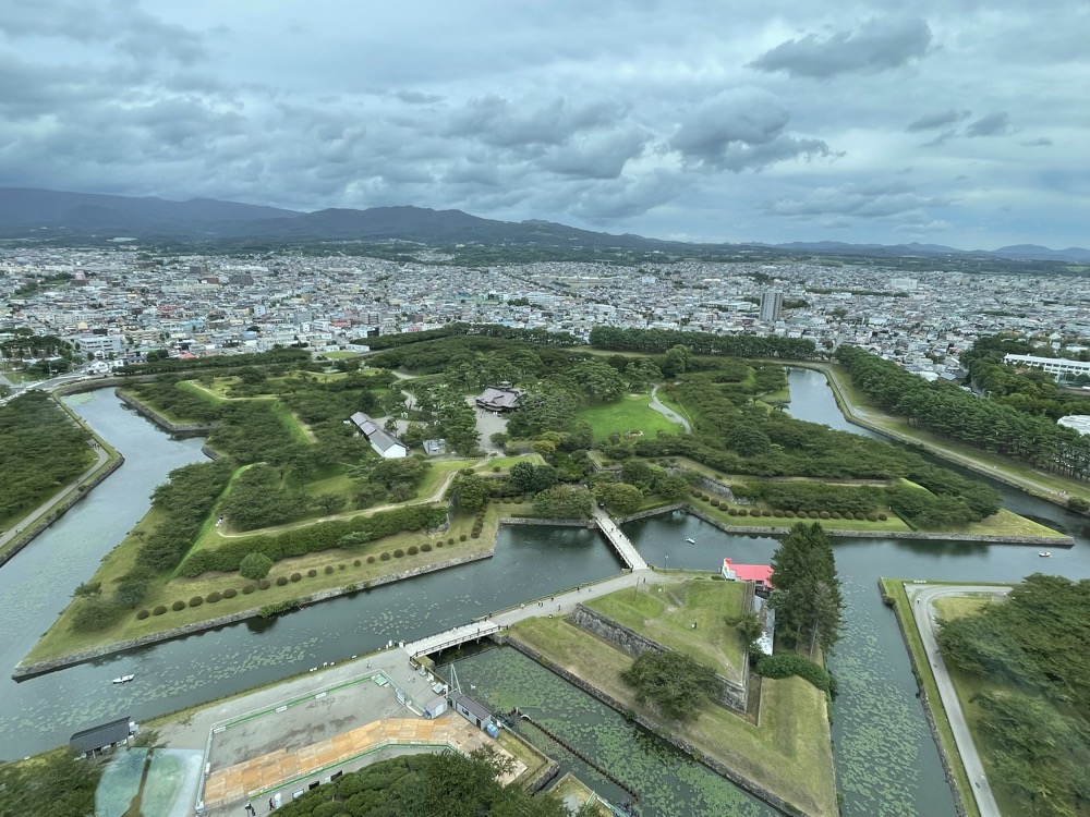
From August 25 to 28, 2022, I took the Shinkansen to Hakodate, picked up a rental car, and drove the southern part of Hokkaido and the Shakotan Peninsula across 3 nights and 4 days. Cape Kamui's blue water, the star shape of Goryōkaku, the seafood at the Hakodate Morning Market, the night view from Mt. Hakodate. Unlike the bike, you don't have to worry about luggage — different freedom.
On Day 3, the Otaru → Cape Kamui → Hakodate stretch went west along the eastern coast of the Shakotan Peninsula via Yoichi, Bikuni, and Cape Kamui. From Cape Kamui I dropped down the western coast of the peninsula on Route 229 as far as Suttsu, hugging the Sea of Japan. From Suttsu I cut inland on Route 5 (Kuromatsunai → Oshamambe → Yakumo) back to Hakodate. Half coast, half inland.
📍 Open route in Google Maps (Day 1 evening: arrive Hakodate, Mt. Hakodate night view → Day 2: Mt. Yōtei, Nikka Yoichi, Otaru → Day 3: Bikuni, Cape Kamui → south on Route 229, then inland on Route 5 from Suttsu → back to Hakodate → Day 4: Hakodate Morning Market, Goryōkaku → depart Shin-Hakodate-Hokuto)
Main Stops
- Hakodate: Mt. Hakodate (night view), Hachimanzaka, Lucky Pierrot, Hakodate Beer, Goryōkaku, Hakodate Morning Market, "First Step on Hokkaido" Monument
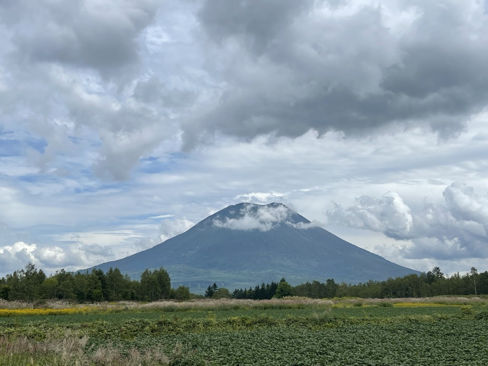
- Niseko / Kutchan: Mt. Yōtei (Ezo Fuji), Mt. Kenashi viewpoint
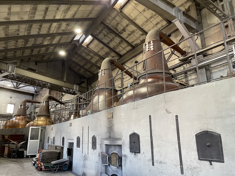
- Yoichi: Nikka Whisky Yoichi Distillery, Yoichi Space Museum "Space Dome" (hometown of astronaut Mamoru Mōri)
- Otaru: Otaru Station, Otaru Canal, Old Temiya Line ruins
- Shakotan Peninsula: Cape Kamui, Bikuni Ōgon-misaki, Sei-zushi Branch
Day-by-day Records
Lodging
- Day 1 (8/25)Oyado Aozora / 22-4 Wakamatsu-cho, Hakodate
- Day 2 (8/26)Hostel Junpū Manpan (run by Otaru University of Commerce students) / 1-21-21 Midori, Otaru
- Day 3 (8/27)Toyoko Inn Hakodate Ekimae Asaichi / 22-7 Ōte-machi, Hakodate
- Day 4 (8/28)Departed Shin-Hakodate-Hokuto 16:20 by Shinkansen
Trip Highlights
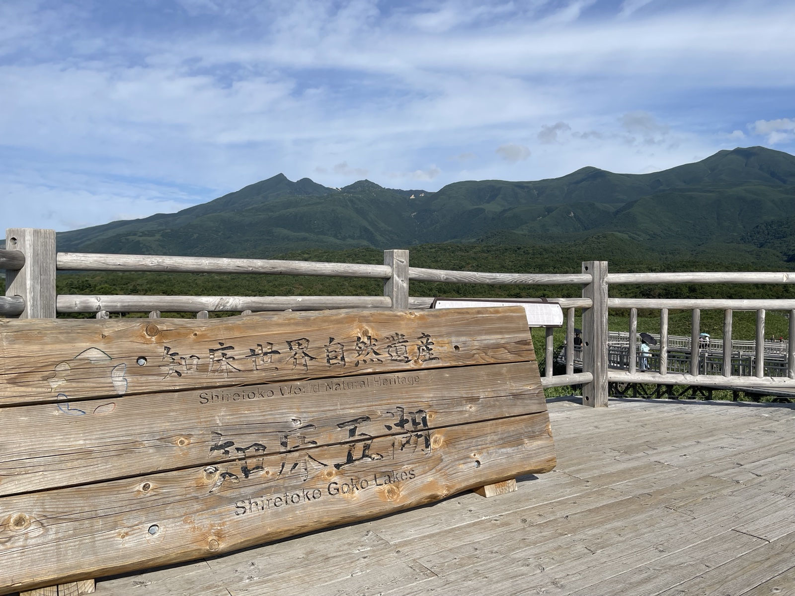
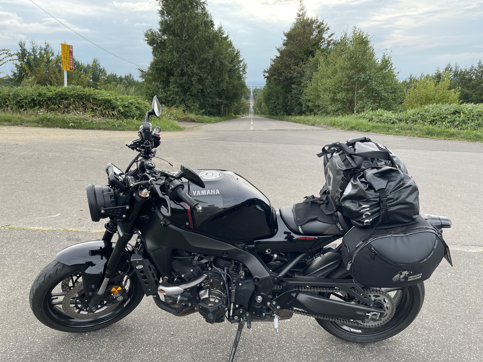
③ XSR900 8-Day Tour — From Ōarai, Looping the East and North
Took the Sunflower ferry from Ōarai to Tomakomai, then looped through Obihiro, Kushiro, Nemuro, Cape Nosappu, Shiretoko, Abashiri, Wakkanai, Asahikawa, and Biei before returning to Tomakomai. Eight days. The XSR900's three-cylinder engine fit Hokkaido's roads.
📍 Open route in Google Maps (Ōarai → Tomakomai → Obihiro → loop the east → Wakkanai → Asahikawa → Biei → Tomakomai → Ōarai)
Day-by-day Records
Lodging
- Day 1Ōarai → Tomakomai ferry (Sunflower)
- Day 2Guest House Momo / Higashi 10-jō Minami 8, Obihiro
- Day 3Guest House Tomaya / Nemuro
- Day 4Hotel Roman / Koshimizu Town
- Day 5Hotel Okhotsk Palace Monbetsu / Monbetsu
- Day 6Guest House Moshiripa / Wakkanai
- Day 7Asahikawa Toyo Hotel / Asahikawa
- Day 8Tomakomai ferry
Trip Highlights
Hokkaido Touring Tips (after three trips)
※ This section combines the author's three-trip experience with public information. Confirm fares, schedules and road conditions on the official sites.
Best season & climate
- June: No rainy season; lavender starts late June; long-distance touring kicks off; cool early mornings on a bike.
- July–August: Peak season, average highs 22–26 °C, none of Honshu's brutal heat.
- September: Foliage starts; mornings and evenings drop to ~10 °C in some areas.
- October onwards: Snow risk in mountain passes (Eastern Hokkaido and high passes); riding gear gets quickly demanding.
Booking the ferry
- Ōarai⇄Tomakomai (MOL Sunflower): The standard from the Tokyo area. Evening departure, midday arrival next day; about 19 hours.
- Niigata/Maizuru⇄Otaru (Shin Nihonkai Ferry): For Kansai/Hokuriku; longer but comfortable.
- Motorcycle slots fill fast in summer — book 2–3 months ahead.
- Private cabins cost more but the recovery delta on a 19-hour crossing is real.
Fuel and resupply in Eastern Hokkaido
- Kushiro–Nemuro and around Shiretoko: gas stations are sparse and close early. Sundays and nights are tightest.
- Fill the tank in the morning, lock in the next refill point by early afternoon.
- Convenience stores are also further apart than in the cities — stock water and snacks the night before.
Brown bears and wildlife
- Shiretoko, Rausu, and the northern interior are bear country. Carry a bear bell and bear spray for both touring and camping.
- Foxes and Yezo deer dart onto the road most often around dusk and after dark — slow down on mountain roads.
- At campsites, never store food outside the tent; keep it in the car or a designated container until you break camp.